Researcher Experiences of RI-RI Collaboration Funded by the JERICO-S3 Transnational Access (TA)

Stella Berger, Christian Dilewski, Alexis Guislain, Iordanis Magiopoulos, Sébastien Mas, Behzad Mostajir, Jens Nejstgaard, David Parin, Paraskevi Pitta, Tanguy Soulié, Katerina Symiakaki, Anastasia Tsiola, Francesca Vidussi

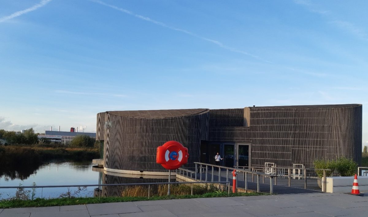
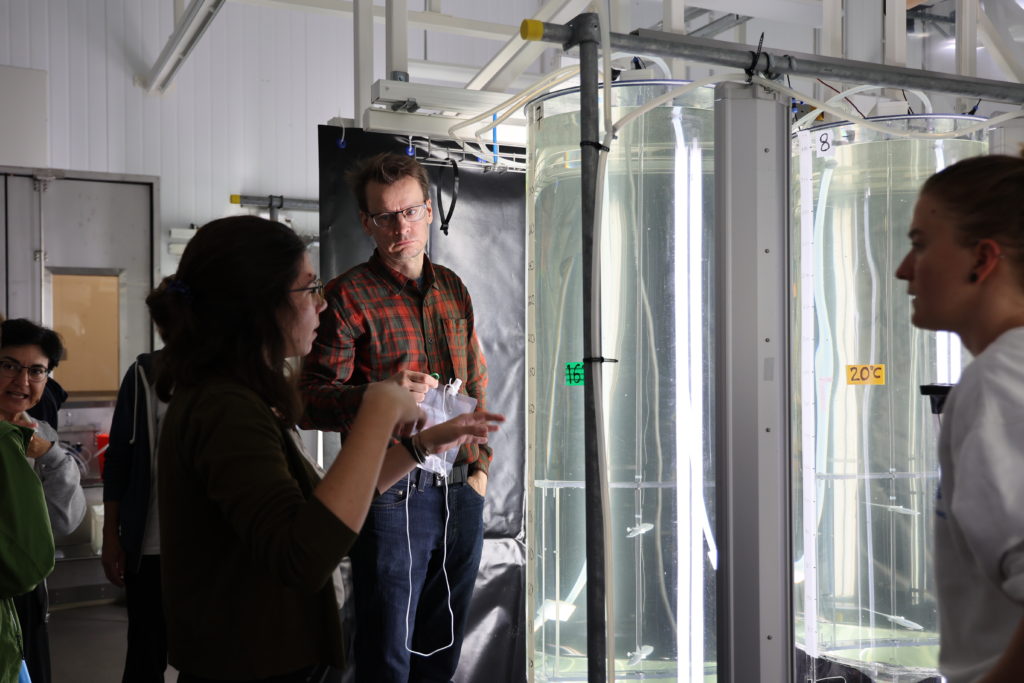
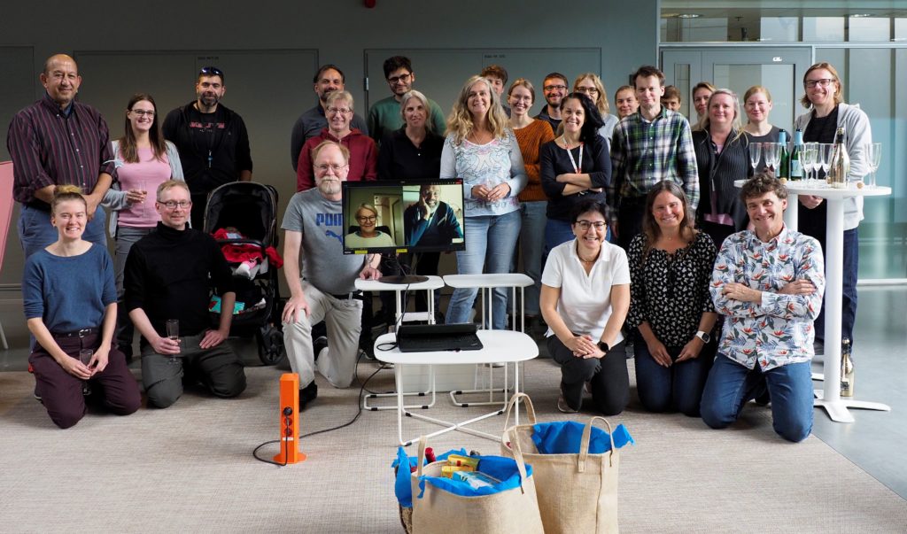
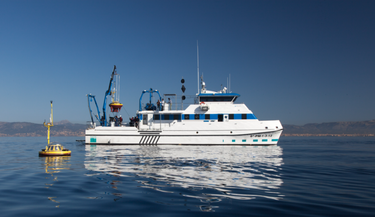
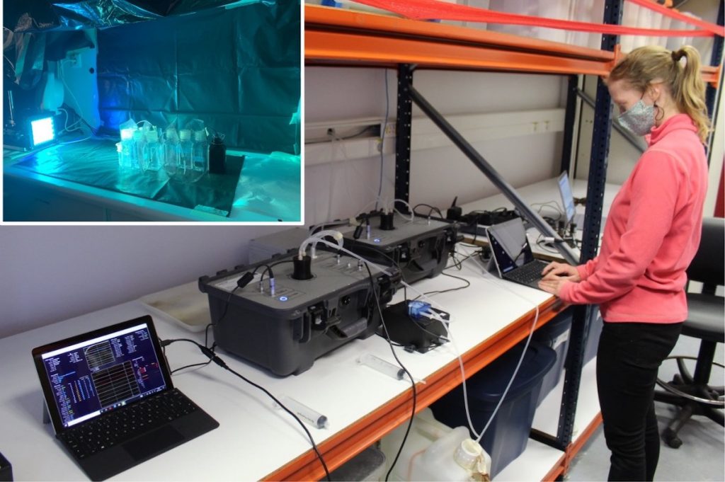
During a Transnational Access of JERICO-S3, called the ‘Joint JERICO-S3 and AQUACOSM-plus study on Baltic Sea heatwaves‘, twelve indoor mesocosms were used to simulate different levels of MHWs at the Finnish Environment Institute (SYKE) in Helsinki from late August to early September 2022, in order to study their impact on the Baltic Sea plankton communities.

Severe anomalous warming events, known as Marine Heat Waves (MHWs), are expected to increase under continued global warming. Although the effect of the temperature increase has been investigated in multiple systems, little is known about the response of plankton communities to Marine Heat Waves (MHV). MHVs are expected to be a major driver of aquatic ecosystems and can modify the interactions between different groups of plankton and shift the structure and functioning of the community, sometimes to an irreversible level.

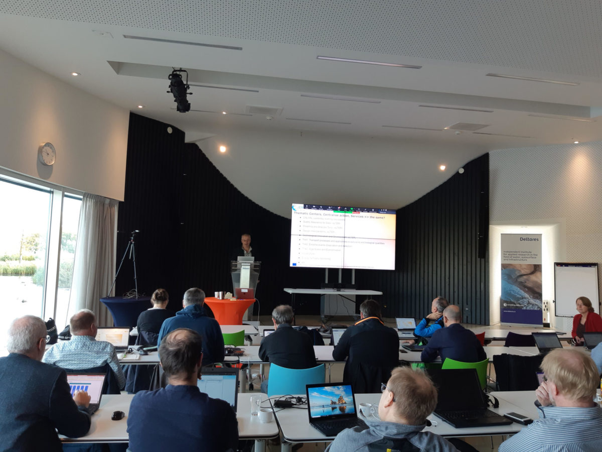
Five scientists from the Leibniz Institute of Freshwater Ecology and Inland Fisheries IGB (Germany), three scientists from the Hellenic Centre for Marine Research HCMR (Greece) and five scientists from the National Centre for Scientific Research CNRS (France), all benefitting from the Transnational Access support of JERICO-S3, participated in this mesocosm experiment in collaboration with more than fifteen scientists of the host laboratory SYKE.

Collage of pictures KK white - the team
Photo credits: Behzad Mostajir, Stella Berger, Jens Nejstgaard, Maiju Lehtiniemi, Katerina Symiakaki, Katri Kuuppo and Anastasia Tsiola. Photo collage credit: Katri Kuuppo.

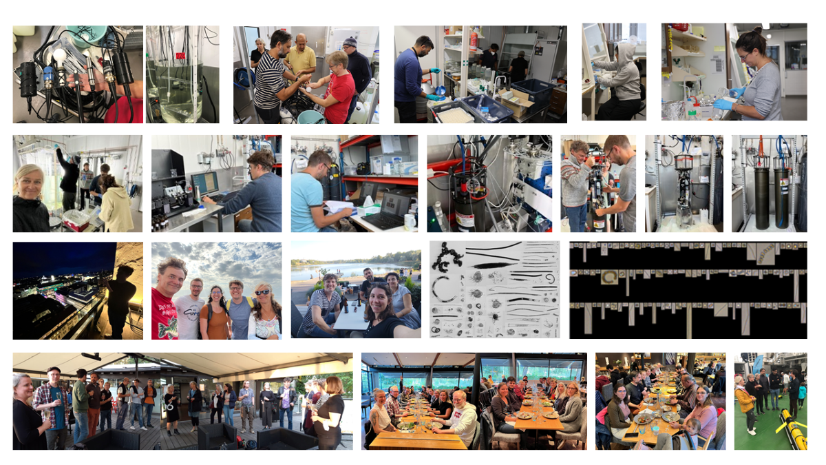
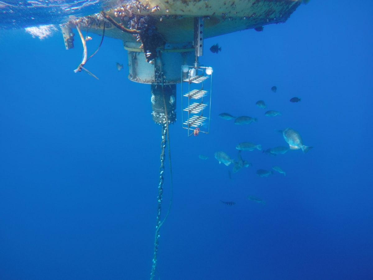
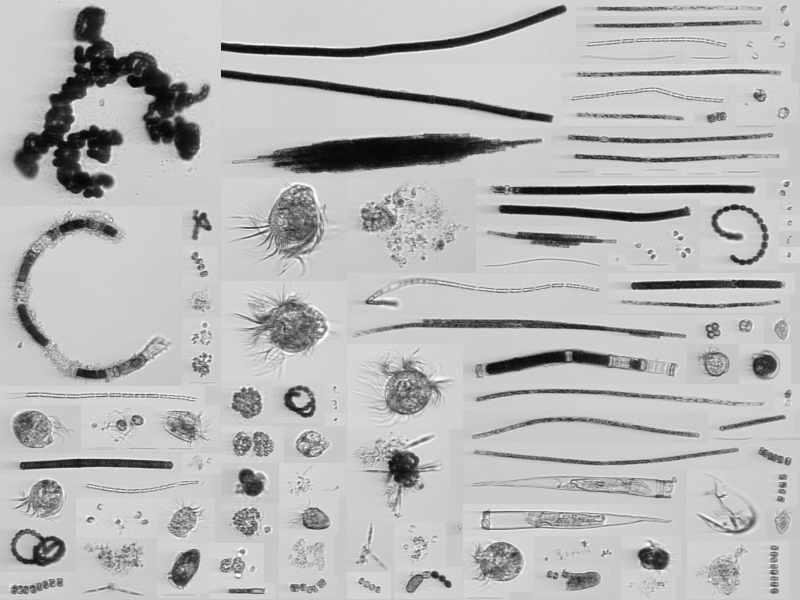
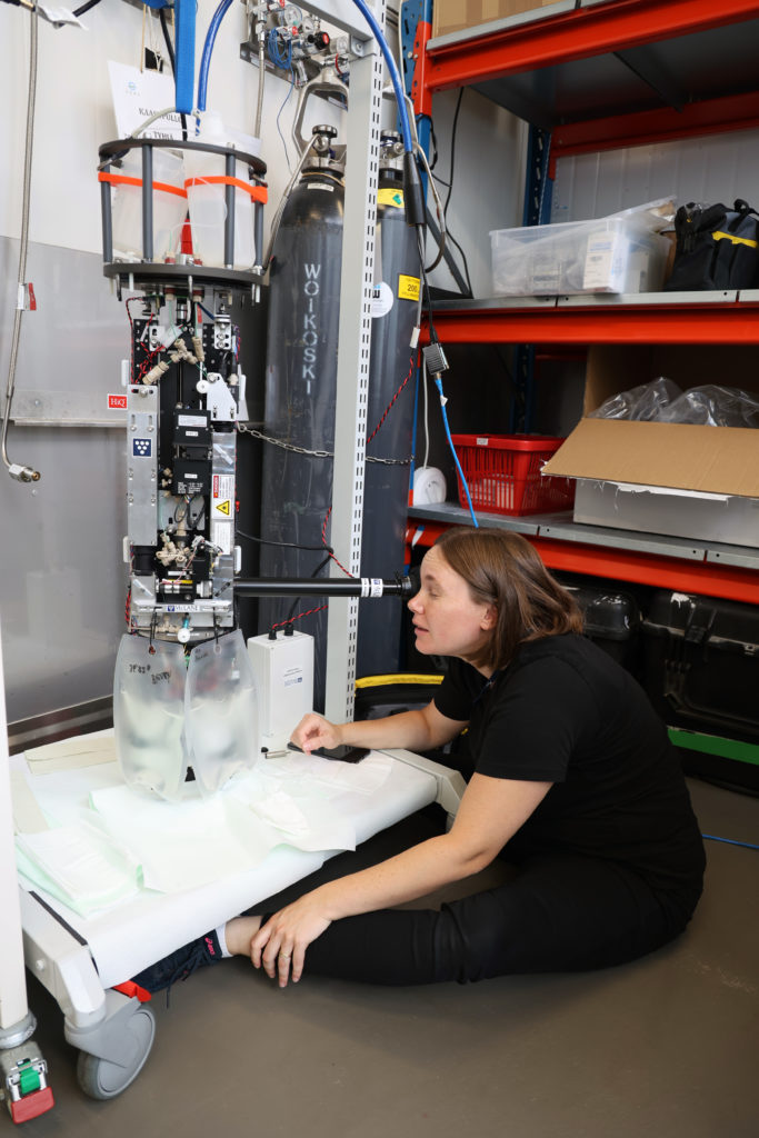
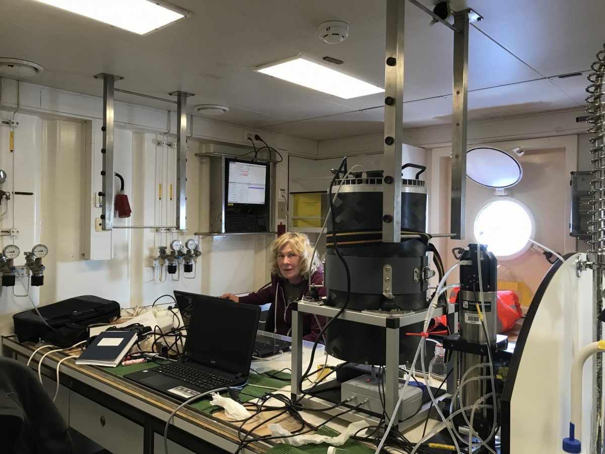
Several physical, chemical and biological variables were monitored for 10 days using various high-frequency sensors, image-based analysis instrumentation and discrete water sampling from mesocosms to estimate the metabolic changes of plankton communities, to identify planktonic species and traits, their abundances and biomasses, and interactions between organisms. As a collaborative team of experts, we could follow the physicochemical environment and the dynamics of planktonic organisms from viruses to zooplankton under different temperature treatments simulating heat waves. In addition, we studied the response of the in-situ microbial and plankton communities to temperature changes, during the warm period of 2022, through regular samplings at the same geographical area from which the mesocosm water was collected.

This great and fruitful collaboration underlines the scientific gain of combination between the experimentation realised in the mesocosms based on the environmental scenarios that come from the observations. This collaboration was a unique opportunity for a common research activity between two state-of-the-art Research Infrastructures, one Experimental-AQUACOSM-plus and one Observational-JERICO-S3. We expect to compare and combine the findings from both, the mesocosm experiment and the in-situ samplings with an aim to develop a more complete picture of the effects of Marine Heat Waves on the planktonic communities and related ecosystem functions of the Baltic Sea. We expect that these results will have relevance for a wider range of planktonic systems under temperature stress, especially in other boreal and temperate areas, where the strongest effects of seasonally increased temperatures have been shown for e.g. terrestrial systems.

CORIS, a UN Ocean Decade endorsed project of CoastPredict

The Coastal Ocean Resource Infrastructure System (CORIS) project was officially endorsed as a UN Ocean Decade Action hosted by the CoastPredict Programme as a core project in September 2022. It is led by the Balearic Islands Coastal Observing and Forecasting System (SOCIB) and will be a key infrastructure to support the coastal ocean activities carried out worldwide by CoastPredict. It directly results from the efforts and achievements of JERICO projects, in particular with the development and design of the JERICO Coastal Ocean Resource Environment (CORE).

oceanpredict jerico-CORE infographic
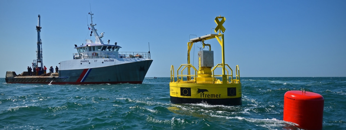
CORIS will provide sustainable delivery of high-quality environmental data and information, products to research, industry, and government for purposes such as ecosystem health, hazard response and resource management.

CORIS builds upon the JERICO-RI and offers a range of services including fully open access to data tools for managing and using data, best practices for observation, data management and user applications, as well as access to relevant documentation.

There is also a virtual workspace for analyses and translating data into information. However, CORIS does not store data but collaborates with global and regional repositories such as EMODnet, NCEI, SAEON, and AODN. This “one-stop shop” will support countries with mature ocean capabilities and developing regions with limited infrastructure.

This Project is hosted by the Ocean Decade Programme CoastPredict – Observing and Predicting the Global Coastal Ocean. CORIS will support all Focus Areas in the CoastPredict Programme.

Key Stats

Start Date: 01/10/2022
End Date: 30/09/2030
Lead Contact: Miguel Vicente Charcos Llorens (mcharcos@socib.es)
Lead Institution: The Balearic Islands Coastal Ocean Observing and Forecasting System (SOCIB), Spain
Geographic coverage: All Ocean Basins
Challenges: Create a digital representation of the Ocean, Project, Skills, knowledge and technology for all, Sustainably feed the global population

About CoastPredict

CoastPredict will redefine the science of observing and predicting the Global Coastal Ocean to help the Ocean decade to succeed in its aims and give us the Ocean we need for the Future we want.

In the Cretan Sea PSS, JERICO-S3 collaborates with EMBRC to complement data series at the Eastern Mediterranean EMO BON observatory and study the effect of extreme events on phytoplankton productivity

underwater photo of technology being used.
Photo of the Marine Monitoring Platform

The Cretan Sea is a subpart of the ultra-oligotrophic eastern Mediterranean Sea. Among the major research challenges in this area, extreme events and their effects on primary productivity is a topic of concern. The JERICO-S3 Cretan Sea Pilot Super Site (PSS), a component of the POSEIDON Operational System, aims to demonstrate the contribution of a PSS approach to such studies via four out of its six actions:

For this purpose, JERICO-S3, via the Cretan Sea PSS of POSEIDON, collaborated with EMBRC-ERIC via EMO BON (European Marine Omics Biodiversity Observation Network) to test ways to obtain additional Essential Biodiversity Variables (EΒVs) data (i.e. improved approximations of primary production), whilst providing access to physicochemical data (temperature, salinity, oxygen, fluorescence, turbidity). The key objective was to contribute additional environmental data series to the Eastern Mediterranean EMO BON observatory site, which monitors biodiversity in the water column, hard substrate and soft sediments. These data are highly relevant to the shift of the Mediterranean biota under climate change pressure.

Concretely, tο study diel to seasonal variations of phytoplankton dynamics in relation to extreme rain events, a mooring CTD (measuring temperature, salinity, oxygen, fluorescence, and turbidity) was used with a sampling frequency increased to 1h (instead of 3h usually used in POSEIDON coastal buoys). The CTD was deployed in 2022 at the seafloor observatory of the Underwater Biotechnological Park (UBPC) of HCMR during three periods varying from 1 to 3 months. The UBPC location provided a higher chance of exposure to extreme rain events (being more coastal than POSEIDON coastal buoys) and more frequent check/recovery (1-2 months) than the usual deployments on buoys (6-12 months). The outcome of these tests will allow studying the feasibility of a future application in POSEIDON buoys.

The video shows the deployment of the monitoring platform in September 2022 and its subsequent retrieval in October 2022.

The activity was organised jointly by the Cretan Sea PSS partners (HCMR, NIVA, SYKE, CNRSMIO).

JERICO-S3 Transnational Access Scientific Cruise in the Mediterranean

Funded by the JERICO-S3 Transnational Access (TA) program, different plastic materials were deployed and retrieved in situ in Mediterranean deep waters to study their degradation.

photo of a white vessel/boat on the water.
Photo of R/V DALLAPORTA.

Specific degradation times of different materials in the deep sea are analysed and compared to other sites by measuring material loss. The method is applied to plastic films, as well as fibrous and fabric materials, shedding light on their residence times in the marine environment.

Two experiments, proposed by HYDRA, were carried out under the JERICO-S3 TA framework using the CNR deep-sea moorings in the Sicily and Corsica Channels to retrieve also hydrographic data and compare plastic degradation rates under different environmental settings.

Please find below the video report of the scientific cruise, which happened in October 2022.

Video report by Christian Clauwers

Autonomous underwater coastal observatory (cEGIM) pre-demo test activities

On December 16th 2022, the autonomous underwater coastal observatory (cEGIM) was deployed at 8 m water depth in the Sainte Anne du Portzic Bay, close to IFREMER (Brest, France). The deployment operations were conducted by a team from IFREMER and pre-demo test activities of this observatory were initiated. 

Photo of Partial view of the cEGIM frame and instruments before deployment.
Partial view of the cEGIM frame and instruments before deployment.

The cEGIM (coastal EMSO Generic Instrument Module) is capable of adapting its configuration to the dynamic conditions of the marine environment. It is being developed by JERICO-S3 WP7 specifically for the coastal ocean environment and variables, based on the EMSO’s EGIM concept.

Photo of Side view of the cEGIM just after deployment near the pier of Sainte-Anne duPortzic.
Side view of the cEGIM just after deployment near the pier of Sainte-Anne du Portzic.

The pre-demo activities, which extend until mid-February 2023, aim to test the whole cEGIM functionalities, including the automated sensor configuration change, data acquisition, storage, and communication.

photo of a top view of the cEGIM just after deployment near the pier of Sainte-Anne du Portzic.
Top view of the cEGIM just after deployment near the pier of Sainte-Anne du Portzic.

JERICO-S3 Training Workshop on High Frequency Radars

The EuroGOOS HFR Task Team Annual Meeting took place in Firenze, Italy, from 21st to 22nd November 2022, gathering around 20 participants. The HFR Task Team meeting, which happened as a side event of the MONGOOS annual meeting, hosted the JERICO-S3 Training Workshop dedicated to the ‘New joint tools for the European HFR Community’.

The EuroGOOS HFR Task Team Annual Meeting started with a quick review of the ongoing Actions of the Task Team. Afterwards, the JERICO-S3 Training Workshop started with a presentation dedicated to the JERICO-CORE, with the title ‘JERICO Coastal Ocean Resource Environment (CORE) as a platform to support HFR activities’, followed by a presentation about the ‘HOORT (HFR Online Outage Reporting Tool): What is it and how does it work?’. ‘The European HFR Node: Quality Control on surface current data’ was also presented and discussed. The day ended with a discussion on the DOI strategy. 

The second day’s morning was dedicated to the HFR Waves, starting with a review of state of the art, followed by presentations about recent advances in HFR Waves from European operators. The morning ended with a discussion session about the HFR Wave data for Copernicus, gaps, and future steps for HFR Waves and Action Plan, with the final wrap-up and conclusions. The afternoon of the second day was focused on hands-on sessions of the ‘New joint tools for the European HFR Community’, with further insight, open discussion, and demonstrations for interested HFR operators. 

IH HFR Workshop Firenze Nov 2022

Laurent Delauney represents JERICO-RI at a session dedicated to European Research Infrastructures at the International Conference on Ecological Sciences in Metz.

The ‘EcologyMetz2022, International Conference on Ecological Sciences & Evolution’ entitled ‘Ecology and Evolution: New perspectives and societal challenges’ conference took place between 21st – 25th November 2022 in Metz, France.

Laurent Delauney (JERICO-S3 coordinator and interim JERICO-DS coordinator, Ifremer, France) represented JERICO-RI and participated as an invited panellist at a special session on European RI’s entitled ‘Advanced facilities for the ecological research: the European Research Infrastructures’

This session focused on the establishment and promotion of European Research Infrastructures (ERIs). The European Commission is strongly promoting the establishment and operation of European Research Infrastructures (ERIs), funded by the Member States, as key components of the scientific research landscape supporting the global competitiveness of European research communities. ERIs are aimed at offering high quality data and advanced facilities to European scientists, with particular attention towards early career researchers, promoting innovation, technology transfer to industries, and citizen engagement in science.

In the area of Ecology, some ERIs have already been established as European Research Infrastructure Consortia (ERIC), and are currently operational, whilst others are in the process of becoming so. Globally, the landscape of European Research Infrastructures offers monitoring sites and facilities covering all types of environmental domains, i.e., terrestrial, freshwater, transitional and marine waters and key research areas, such as those dealing with biodiversity organisation, conservation and restoration, with ecosystem processes and carbon sequestration, water and energy fluxes or with agroecosystems. 

The session included an expert panel, with leading scientists from advanced ERIs supporting European scientific research on biodiversity and ecosystems.

scientists at the Metz International Conference on Ecological Sciences

The expert panel included scientists from LifeWatch ERIC (the European e-Science Infrastructure for Biodiversity and Ecosystem Research), the ecosystem component of ICOS ERIC (the Integrated Carbon Observation System), eLTER RI (the Long Term Ecological Research site network), DiSSCo (the Distributed System of Scientific Collections), Danubius-RI (the International Centre on Advanced Studies on River-Sea Systems), the marine Research Infrastructures JERICO-RI (the Joint European Infrastructure of Coastal Observatories), EMBRC ERIC (the European Marine Biological Resource Centre), and EMSO ERIC (the European Multidisciplinary Seafloor and water column Observatory).

The expert panel presented their key integrated research facilities to the SFE2 GFÖ EEF Conference, what these infrastructures offer to the relevant ecological research community of practice, a view of their data, services and other types of research resources, the opportunities for engagement, and on the possibilities to propose new types of data and services to be promoted, collected, and developed by the ERIs. 

The discussion focused on the major scientific and societal challenges of contemporary times and on the greatest threats faced by biodiversity, ecosystem services and societal benefits, in the context of natural and anthropic pressures, including climate change impacts. The leading scientists presented how each ERI is committed to collaboratively tackling these issues, supporting the creation of new multidisciplinary and cross-domain knowledge towards facilitating the implementation of current policies at all levels and the creation of new ones. They demonstrated how scientists can access their integrated research facilities.   

The session was organised by LifeWatch ERIC (Alberto Basset (University of Salento & LifeWatch), Christos Arvanitidis (LifeWatch ERIC), Juan Miguel González-Aranda (LifeWatch ERIC), Peter van Tienderen (University of Amsterdam & LifeWatch ERIC), Dario Papale (University of Tuscia & ICOS ETC).

photo of a poster from the Metz International Conference on Ecological Sciences event

About LifeWatch ERIC

LifeWatch ERIC is a European Research Infrastructure Consortium with a mission to provide digital access to global biodiversity content, services, and communities.

Established by the European Commission in 2017, the consortium is dedicated to addressing key planetary challenges and providing e-Science research facilities for the purposes of investigating biodiversity and ecosystem functions and services with the aim of supporting society.

JERICO-DS General Assembly 2022

The JERICO-DS General Assembly took place at Deltares in Delft (Netherlands), from 25th to 27th October 2022, and gathered around 35 participants. The JERICO-DS project develops the design study of the Joint European Research Infrastructure for Coastal Observatories (JERICO-RI) and is funded by the European Commission’s H2020 Framework Programme under grant agreement No.951799.       

photo of a building by the water - Deltares in Delft (Netherlands)
Credit: IH team

The JERICO-DS General Assembly started with a presentation and discussion about the status of the different JERICO-DS work packages. Subsequently, a series of dedicated sessions were held during the three days of the meeting to discuss the progress and difficulties on specific aspects of the design of the JERICO-RI, such as the Scientific Strategy, the implementation of the JERICO-CORE (the hub for access to the products and services of the JERICO-RI), the technology roadmap, the JERICO-RI future governance, legal entity and status, the JERICO Label, Human Resources, Key Impact Indicators, Business Case, Funding Plan, and Sustainability and Communication Strategy. The second day included the meeting of the National Representative. 

General Assembly scientists in a meeting room watching presentation
Credit: IH team

The JERICO-DS General Assembly was concluded in the afternoon on 27th October 2022, with a ‘wrap up’ of the different sessions and enthusiastic thanks from all partners to the team of Deltares for the excellent organisation of the event. This ended three exciting days during which JERICO-DS partners shared ideas and experiences about the design and future evolution of JERICO-RI, having the beautiful city of Delft as a background. 

JERICO-S3: 4th Call for Transnational Access Now Open

The JERICO-S3 Research Infrastructure is opening a final 4th call for the Transnational Access (TA) funding program. The call is open from 20th October to 21st November 2022. Please note, all proposed projects must be scheduled to complete the experiment by September 2023 with the final report submitted no later than October 2023.

Transnational Access provides free of charge access to high-quality infrastructures and support services at unique multi-disciplinary facilities consisting of a range of gliders, fixed platforms, ferryboxes, cabled observatories, HF radar, benthic stations, and bio-sensors. Applicants will be able to apply for a travel grant for the purpose of visiting the host facility for conducting their experiment. More than 4400 days of Transnational Access is offered between June 2020- January 2024 to 43 integrated marine coastal observation infrastructures located at 21 JERICO-RI partners throughout Europe. Detailed information about each JERICO-RI facility, technical design, and available resources etc. can be found here.

Successful applicants will be facilitated in conducting first-class experiments on one or more of the multi-disciplinary coastal observing systems thus maximising impact for science, environmental managers, industries and other relevant stakeholders. Users will have access to the best available equipment and knowledgeable personnel at each of the facilities to enable improved research outputs and scientific excellence. JERICO-S3 TA supports a diverse international user group and proudly supported International Women in Science Day this February by highlighting 3 women Principal Investigators of TA projects.

The three successful JERICO-S3 TA calls have supported 42 projects with a list of project summaries online. From these projects, we’ve seen tremendous work in the JERICO-RI Pilot Supersites (PSSs) as seen by Lase-Nopah and EuroFluoro in JERICO-S3 Cretan Sea Pilot Supersite. More recently, SYKE hosted three JERICO-S3 TA – AQUACOSM-plus projects in a unique collaboration of international scientists. We welcome and encourage projects from all user groups including those from non-EU countries subject to the terms and conditions outlined in the guidance notes.

We strongly encourage all TA applicants to contact the respective facility providers as early as possible in the proposal process about possible usage of facilities and cooperation at the infrastructures. Please ensure that the objectives and aims of the call are fully addressed before submitting a proposal for Transnational Access. The TA application form and Guidelines can be found online.

This is a unique opportunity for scientists and engineers to avail of high-quality, interlinked instrumented infrastructures operating in coastal and shelf-sea areas for conducting research and/or testing activities.

Contact JERICO.TA (at) marine.ie / jerico.ta@marine.ie for more details.

photo of NIVA ship on the water/in the sea
NIVA ferrybox, Credit © NIVA, Color Line, Hurtigruten


LASE-NOPAH TA: levels and air-sea exchange of nitrated and oxygenated polycyclic aromatic hydrocarbons in the Cretan Sea

Over the last year, the LASE-NOPAH Transnational Access (TA) took place, following a RECETOX, Masaryk University (Czech Rep.) TA application. The aim of this TA was to study the diffusive air-sea exchange of organic pollutants such as nitrated and oxygenated polycyclic aromatic hydrocarbons (NPAHs, OPAHs) in the surface waters of the Mediterranean.

It was hosted at the HCMR POSEIDON E1-M3A and HCB buoys in order to benefit respectively from an off-shore station and a coastal station located in the Mediterranean Sea (Greece). The buoys form part of the JERICO-S3 Cretan Sea Pilot Supersite.

Air passive sampler (bell shape) placed on the main mast of the buoy
Air passive sampler (bell shape) placed on the main mast of the buoy.

In the framework of the project, SSP, Speedisk, PFC, and silicone sheet water passive samplers, as well as polyurethane foam disks (PUF) air passive samplers, were deployed successfully in parallel in both buoys. In total, three deployments and three retrievals were undertaken seasonally (autumn, spring, and summer) from November 2021 until July 2022. All samplers were recovered safely for chemical analysis to deliver data that will enable the characterisation of the water contamination profile and the assessment of the main seasonal fluctuation.

Water passive sampler placed under the buoy
Water passive sampler placed under the buoy.

About the JERICO-S3 Pilot SuperSites

JERICO-S3 will provide regionalised innovative monitoring and science strategies at 4 Pilot Supersites in The Gulf of Finland, the North-western Mediterranean, The North Sea and the English Channel and the Cretan Sea.

The Pilot Supersites (PSSs) were established and tested during a short implementation period (January 2021 to August 2022) to demonstrate how transnationally and trans-institutionally integrated multidisciplinary and multiplatform observations add value to our ability to answer the multiple key scientific and social challenges that the coastal ocean is facing.

Joint JERICO-S3 and AQUACOSM-plus study on Baltic Sea heatwaves

Climate change is causing increasingly frequent heat waves, which not only hit land areas, but also coastal seas. An increase in the water temperature affects the life of plankton and the pathways of nutrients and carbon. Because of the sporadic nature of the heatwaves, their effects are hitherto poorly known. Studying their multifaceted and complex effects on coastal seas requires an interdisciplinary approach.

IFCB plankton image

Long-term coastal observations and the use of novel sensors in the JERICO-RI are able to reveal the frequency and magnitude of heat waves and provide a basic understanding of bulk changes in plankton communities. A more in-depth understanding of the heatwaves on planktonic processes requires further targeted research, e.g., the experimental approach by AQUACOSM-plus, in which mesocosms studies with active manipulation of natural plankton communities are used.

In August 2022, we monitored a heatwave in the Gulf of Finland, by continuous measurements of several parameters at the JERICO Pilot Supersite ferries and fixed platforms.

IFCB Kaisa on the floor
IFCB Scientist, Kaisa

At the same time (22.8.-2.9. 2022), we conducted a mesocosm experiment using the AQUACOSM indoor mesocosm facility at the Finnish Environment Institute SYKE, Helsinki. In the experiment, we exposed natural plankton communities from the Gulf of Finland to elevated temperatures.

With the support of the Transnational Access of JERICO-S3, international groups from Lake Lab of the Leibniz Institute of Freshwater Ecology and Inland Fisheries IGB (Germany), the Hellenic Centre for Marine Research HCMR (Greece) and the National Centre for Scientific Research CNRS (France), participated in the experiment jointly with the scientists of SYKE.

Katerina Pasi Mesocosm
Katerina Pasi with the Mesocosm

The mesocosm experiment, which was carried out indoors, involved high-frequency measurements of plankton ecosystem structure and functioning using the autonomous sampling and analysis instrument AquaBox, sensors and imaging systems, as well as the kinetics of planktonic organisms from viruses to zooplankton. The unique combination of collaborative observations and experimentation greatly facilitated the research of this complex environmental challenge.

The experiment is the third in the series of JERICO-AQUACOSM collaborations. The previous experiments were carried out in the NW Mediterranean and the Cretan Sea, where the effects of riverine loads and air-borne aerosols on plankton ecosystems were studied.

group photo of the scientists
Group photo from the experiment


SOCIB Data Catalogue: free and open access to regional ocean data

The SOCIB Data Catalogue is an intuitive web application designed to access, visualise, plot, and download multi-platform metocean data collected by SOCIB’s observing system in the Western Mediterranean Sea.

As a contribution to the JERICO-S3 project, and more specifically in the frame of the virtual access to coastal ocean resources efforts, the Balearic Islands Coastal Observing and Forecasting System (SOCIB) have developed a browser-like application, the SOCIB Data Catalogue, built on top of the SOCIB Data API service, that enables user-friendly access, visualisation, plot, and download of the data available at the SOCIB Data Repository. This catalogue is the recommended entry point for non-operational users interested in the multi-platform metocean data collected by SOCIB’s observing systems in the Western Mediterranean Sea. Operational users are encouraged to consider this application as a Use Case of the SOCIB Data API, the service currently providing machine-to-machine access to the repository. Furthermore, the SOCIB Data Catalogue enables access to SOCIB’s data products, that is data packages based on the observational programmes and scientific projects of SOCIB, with a higher level of curation and data version control.

The SOCIB Data Repository contains a wide range of Essential Ocean Variables (EOVs) covering from physics (sea water temperature, seawater salinity, currents, sea surface height, etc.) to biochemistry (nutrients, oxygen, turbidity, etc.) and biology (chlorophyll mass concentration, etc.). This is in addition to providing related meteorological variables (atmospheric pressure, wind velocity, and direction, air temperature, and humidity, etc.). The data, either reported by observing facilities (oceanographic buoys, drifters, profilers, gliders, high-frequency radars, etc.) or outputs from hydrodynamical (WMOP), wave (SAPO) or meteorological (BRIFS) numerical models, facilitates the monitoring and forecast of the ocean state and variability in the frame of a number of projects and observational programmes with a particular focus on the Western Mediterranean Sea.

The SOCIB Data Catalogue and the SOCIB Data API are two examples of SOCIB’s commitment, as a Regional Marine Research Infrastructure, to the FAIR Data Principles (Findable, Accessible, Interoperable, and Reusable). Indeed, the SOCIB Data Repository has recently been certified as a Trustworthy data repository by the CoreTrustSeal Standards and Certification Board, thus guaranteeing the management of research data in line with FAIR Data Principles and Horizon Europe Open Science requirements.

SOCID Buoy

JERICO-S3 activities in the area of Citizen Science presented at the United Nations

The twenty-second meeting of the ‘United Nations Open-ended Informal Consultative Process on Oceans and the Law of the Sea’ was held at the United Nations Headquarters in New York from 6 – 10 June 2022.

The Informal Consultative Process was established by the General Assembly in 1999 in order to facilitate its annual review of developments in ocean affairs and the law of the sea. Annual meetings are held with a different topic of focus each year. The twenty-second meeting held this year focused its discussions on the theme ‘Ocean observing’.

Joao Vitorino from Instituto Hidrografico (Portugal), partners in JERICO-S3, participated in the second segment of the discussion panel, held on 8 June and titled ‘International cooperation and coordination in advancing ocean observing and addressing related challenges. The presentation to the delegations titled ‘Citizen science and the engagement of non-scientific communities’, focused in particular on the potential key role of Citizen Science in contributing to the overall observational effort in coastal ocean areas and the articulation with coastal ocean observatories.

This was an opportunity to present several aspects of the activities being developed by JERICO-S3 in the area of Citizen Science initiatives along the coastal ocean areas of Europe. The presentation to the delegates was followed by a session of questions where several important aspects of this subject were discussed.

citizen science image

Four marine research positions open at the Finnish Meteorological Institute

The Finnish Meteorological Institute is a high-profile research and service organisation responsible for atmospheric, marine and space observations, and research in Finland. Annually, the 600+ employees at the FMI publish more than 400 peer-reviewed articles in leading international journals, including Nature and Science.

FMI is currently seeking applicants for four temporary positions located at The Finnish Meteorological Institute (Dynamicum). These job vacancies include: ‘postdoctoral researcher position on autonomous marine observations’, ‘postdoctoral researchers position on sea ice modelling’, ‘researcher/ocean modeller’, and ‘marine expert/designer for quality assurance (substitute)’.

Postdoctoral Researcher position on autonomous marine observations

The Finnish Meteorological Institute is seeking applicants for the position of ‘Postdoctoral Researcher position on autonomous marine observations’. The contract is for 2 years and will begin on 1st September 2022. The position includes a probationary period of six months and is located at The Finnish Meteorological Institute (Dynamicum).

A suitable person has previous experience (experimental and/or working with data) in marine research using gliders, Argo floats, and/or other autonomous marine research instruments.

Candidates with a PhD degree in a relevant field (oceanography, physics, environmental sciences, marine engineering, or limnology) will be considered. Furthermore, a successful candidate must meet the following essential criteria:

  • Prior experience working with gliders, Argo floats and/or other autonomous marine observing platforms
  • Experience in doing research and publishing the results in peer-reviewed journals
  • Ability to analyse marine data and program using either Python (preferred) or Matlab
  • Fluency in written and spoken English
  • Good communication and interaction skills

This position will include participating in experimental observations with gliders and Argo floats, analysing data, publishing the results, participating in the writing of research funding proposals and other relevant work on European and national marine research infrastructures, like GROOM, EURO-ARGO, JERICO-RI, and the Finnish Marine Research Infrastructure FINMARI.

Deadline for application is 12th  June 2022

Postdoctoral researchers’ position on sea ice modelling

The Finnish Meteorological Institute is seeking applicants for the position of ‘Postdoctoral researchers position on sea ice modelling’. The contract is for temporary employment and will begin on 1st September 2022. This position is located at The Finnish Meteorological Institute (Dynamicum). FMI is seeking a highly motivated scientist to focus on developing a high-resolution sea ice modelling system.

Candidates with a PhD degree in a relevant field (e.g. physics, geophysics, physical oceanography, meteorology, applied mathematics, engineering) will be considered.

Furthermore, a successful candidate must meet the following essential criteria:

  • Experience and merits in scientific publishing
  • Fluency in written and spoken English
  • Good communication and interaction skills
  • Ability to carry out independent research as well as work as part of a team
  • Experience in numerical modelling

The position is funded by the Academy of Finland project, focusing on the development of Digital Twin for the design and management of Off-shore Wind Farms.

Deadline for application is 10th June 2022

Researcher/Ocean modeller

The Finnish Meteorological Institute is seeking applicants for the position of ‘Researcher/Ocean modeller’. The contract is for 2 years and will begin on 1st September 2022. The position includes a probationary period of six months and is positioned at The Finnish Meteorological Institute (Dynamicum).

The successful candidate will work in the Marine Dynamics group with main duties in the Copernicus Marine Service Baltic Sea Monitoring and Forecasting Center (CMEMS BALMFC).

Candidates with a PhD degree in relevant fields (e.g. physical oceanography, meteorology, physics or applied mathematics) will be considered. Furthermore, a successful candidate must meet the following essential criteria:

  • Strong background in physical oceanography
  • Skilled in numerical modelling
  • Good publication record
  • Fluency in written and spoken English, and willingness to work internationally
  • Ability to carry out independent research as well as work as part of a team

The main tasks include the development and validation of the NEMO ocean model for the Baltic Sea with the aim of improving the CMEMS BALMFC service. Expected model developments include improvements to model bathymetry, mixing parameterizations, wave coupling, and data assimilation.

Deadline for application is 7th June 2022

Marine Expert/Designer for Quality Assurance (substitute)

The Finnish Meteorological Institute is seeking applicants for the position of ‘Marine Expert/Designer for Quality Assurance (substitute)’. The position is for a fixed-term employment period from 14th June 2022 to 30th May 2023 (including a three month probation period) and is located at The Finnish Meteorological Institute (Dynamicum).

Candidates with a master’s degree in science will be considered for the position, e.g. geophysics or meteorology (new graduates will also be considered).

Furthermore, a successful candidate must meet the following essential criteria:

• Experience in similar or equivalent types of tasks, familiarity with the field of work
• Readiness and experience to work alone
• Self-initiative and cooperation
• Good written and oral proficiency in Finnish
• Programming skills (Python, SQL)

The duties of a marine expert include the daily quality control of marine observations (e.g. water level, seawater temperature, wave height). Tasks also include participating in the emergency response of all station networks, development tasks related to maritime observations, and performing data analysis.

Deadline for application is 27th May 2022

FMI job post

Ifremer job vacancy: European coordinator – JERICO-RI (H/F)

Ifremer is currently recruiting a full time ‘European coordinator – JERICO-RI (H/F)’ in the department of ‘Département Oceanographie et Dynamique des Ecosystemes’. This position is located in Brest, France, and is an exciting opportunity that encourages applicants with aligned interests in:

  • Protecting and restoring the ocean
  • Sustainable use of marine resources to benefit society
  • Creating and sharing ocean data, information, and knowledge.

Main duties for this position will include: the coordination of the JERICO-Design Study project and the scientific coordination of the JERICO-S3 project, ensuring that JERICO-RI is strategically positioned in the landscape of Environmental/Earth system European Research Infrastructures, that the national research infrastructure IR ILICO is well integrated as the French node of the European infrastructure JERICO-RI and that IR ILICO benefits from JERICO’s advances, and optimising contributions and outputs of establishing JERICO-RI for Ifremer teams and those of other French organisms (ie. network development, funding opportunities, resource pooling).

Required knowledge, skills, and characteristics include initial training in marine sciences (PhD or equivalent experience), experience in fundraising, grant writing, coordination and management of European projects, technical skills, and personal qualities & soft skills.

Deadline for applications: 8th June 2022

JERICO TA Facility Highlight

This month we would like to highlight a selection of unique facilities from the wide range of JERICO-RI facilities that are available for the 3rd Transnational Access Call which is open until 3rd May 2022. Below is a selection of host facilities that provide services to high-quality infrastructures ranging from cabled observatories and fixed platforms to gliders and ferry boxes. A full list of facilities and infrastructures can be found here. Please contact the respective facility operators for developing project proposals.

Project proposals are now being accepted for the 3rd call by applying using the application form and more information can be found in the Guidance Notes. Please email Jerico.TA@marine.ie with any queries.

COAST-HR SMILE buoy (IR-ILICO) (SMILE)
Photo Credit: IFREMER

Facility: COAST-HR SMILE buoy (IR-ILICO) (SMILE)
Infrastructure type: Fixed Platform
Location: Seine Bay, France

The SMILE buoy was developed and implemented by Ifremer (French Research Institute for Exploitation of the sea) in cooperation with the Caen University in 2015. The system is located in the Seine Bay (eastern English Channel) and is influenced both by marine coastal and freshwaters. It consists of a moored buoy with physico-chemical and biological sensors working in continuous and autonomous conditions to provide near real-time data. This system records with a high-frequency resolution (30 minutes), the following parameters at the surface and sea surface: wind direction and speed, relative humidity, aerial PAR, sea temperature, turbidity, salinity, dissolved oxygen, and fluorescence.

For more information about the SMILE buoy please visit their website.

Facility: COSYNA Underwater Node Helgoland (UNH)
Infrastructure Type: Cabled Observatory
Location: German Bight, North Sea

COSYNA UNH is a cabled underwater observatory operated by AWI together with Hereon since 2012 and is providing power, network connection and server support for the permanent operation of in situ sensor systems. The node system has 10 underwater pluggable access points (for network (100 Mbit/1Gbit) and power (48V/2.5 Amp) and is equipped with a standard sensor carrier with an ADCP and a CTD plus Chl-a fluorescence, oxygen and turbidity sensors for basic oceanographic measurements. The 10 access points are fully remotely controlled. The user gets a “virtual computer” on the COSYNA server on which they can log in via remote access software and install their own programs to control their sensor.

The following websites provide more information on UNH:

 
Marine Institute
Photo Credit: Marine Institute

Facility: SmartBay Glider
Infrastructure Type: Glider
Location: Galway, Ireland

The SmartBay Glider, owned and operated by Marine Institute, is a Slocum G3 Teledyne Webb Slocum Glider capable of operating autonomously for 90 days to a maximum depth of 1000m. The glider is used to efficiently collect oceanographic data. Sensors onboard include CTD, Optical DO2, Fluorescence and Turbidity. All data is transferred to the Marine Institute via Iridium communications. The Marine Institute provides a skilled operational team for testing, deployment, and recovery of the glider.

For more information on the SmartBay glider, please refer to the Marine Institute website.

Facility: CEFAS FerryBox
Infrastructure Type: FerryBox
Location: United Kingdom

The FerryBox system on RV Cefas Endeavour is used for autonomous and continuous collection of the sea surface oceanographic data. The core variables include sea surface salinity, sea surface temperature, turbidity, chlorophyll fluorescence, oxygen, nutrients and meteorological parameters. A flow cytometer could be connected if requested.

JERICO-S3 opens 3rd call for Transnational Access

The JERICO-S3 Research Infrastructure would like to announce the opening of the 3rd call for the Transnational Access (TA) funding program.

Transnational Access provides free of charge access to high-quality infrastructures and support services at unique multi-disciplinary facilities consisting of a range of gliders, fixed platforms, ferryboxes, cabled observatories, HF radar, benthic stations, and bio-sensors. Applicants will be able to apply for a travel grant for the purpose of visiting the host facility for conducting their experiment.

The call will be open from 1st March to 3rd May 2022. Please note, all proposed projects must be scheduled to complete the experiment with the final report submitted by September 2023.

Successful applicants will be facilitated in conducting first-class experiments on one or more of the multi-disciplinary coastal observing systems thus maximising impact for science, environmental managers, industries and other relevant stakeholders. Users will have access to the best available equipment and knowledgeable personnel at each of the facilities to enable improved research outputs and scientific excellence. JERICO-S3 TA supports a diverse international user group and proudly supported the International Women in Science Day this February by highlighting 3 women Principal Investigators and the TA projects that they lead. We welcome all project user groups including those from non-EU countries subject to the terms and conditions outlined in the guidance notes.

In this third call, JERICO-S3 encourages projects between JERICO-S3 Research Infrastructures and AQUACOSM-plus TA. As a specific action, JERICO-S3 and AQUACOSM-plus study jointly how extreme events affect plankton ecosystem, by applying both observations on natural communities and by experimentation at selected sites (Cretan Sea, North-West Mediterranean and Baltic Sea). Currently, AQUACOSM-plus TA has an open call for SYKE MRC lab project which would facilitate a unique RI-RI collaboration.

More than 4400 days of Transnational Access is offered between June 2020- January 2024 to 43 integrated marine coastal observation infrastructures located at 21 JERICO-RI partners throughout Europe. Detailed information about each JERICO-RI facility, technical design and available resources etc. can be found here. The previous two successful TA calls have seen 30 projects accepted for funding to date. TA summaries for projects from the first and second calls are available to view with many of the projects at various stages of completion or in the final stages of the contracts.

We strongly encourage all TA applicants to contact the respective facility providers as early as possible in the proposal process about possible usage of facilities and cooperation at the infrastructures. Please ensure that the objectives and aims of the call are fully addressed before submitting a proposal for Transnational Access. The TA application form and Guidelines can be found online.

This is a unique opportunity for scientists and engineers to avail of high-quality, interlinked instrumented infrastructures operating in coastal and shelf-sea areas for conducting research and/or testing activities.

Contact JERICO.TA (at) marine.ie /jerico.ta@marine.ie for more details.


Picture of the PLOCAN platform, credit PLOCAN.

Knowledge Hub on Sea Level Rise Stakeholder Survey

The Knowledge Hub on Sea Level Rise is a new joint effort by our JPIs focusing on regional to local sea-level changes, currently bringing together over 50 European experts. Together they aim to provide a networking platform where researchers, policymakers and stakeholders can exchange on sea-level rise drivers, impacts, decision-making and policy options.

They are currently working with identified stakeholders to organise a series of workshops, each dedicated to a European Sea Basin, in the coming months (March-April 2022). The results from the workshops will shape the agenda for a larger, pan-European expert conference to be held in Venice towards the end of this year, as well as an assessment report drawing from conference outcomes.

In order to inform these activities, making them successful and useful to stakeholders such as yourself, they have just launched a survey to identify what sea-level rise-related issues we should address and prioritise.

We hope you will participate, as your voice is important to us. This is an opportunity for you to set the agenda of our platform and the upcoming conference and will take about 5-10 minutes to respond. If you would like to participate in any of our activities and workshops, you can express your interest in the survey.

The survey will be open until 21 February 2022.

A first pH annual cycle in the Cretan Sea

The Cretan Sea is a subpart of the ultra-oligotrophic eastern Mediterranean Sea. In this area, major research challenges include gaining a better understanding of the trends and drivers of pH and the air-sea CO2 flux as well as improving our estimates of net primary productivity (a large part of the primary production being at depths out of satellite reach for most of the year).

The JERICO-S3 Cretan Sea Pilot SuperSite (PSS) aims to demonstrate the contribution of a PSS approach to study such challenges via six actions:

The absorption of excess atmospheric CO2 by the oceans causes changes in seawater pH, a phenomenon called ocean acidification. To contribute to ocean acidification observation, since December 2020 a pH sensor deployed in the Cretan Sea PSS is providing pH data, contributing to actions #1, #4, #5. The sensor (SP200-SM, Sensorlab) deployed at the subsurface, on the POSEIDON Heraklion Coastal Buoy (HCB) provides pH data every 3 hours in near real-time (NRT). In parallel, water samples for pH analysis are taken approximately every month to check the sensor’s operation. The samples are analysed using a lab pH instrument (AFT-pH, Sunburst Sensors), which is regularly checked against TRIS buffer as reference material.

It is the first time that an annual pH cycle is obtained in the Cretan Sea and to the best of our knowledge the second time at high frequency (<day) in the eastern Mediterranean (another cycle done in Saronikos Gulf in 2013; González-Dávila et al. 2016). The delayed mode data provided by the pH sensor, after processing, are in good agreement with data from samples (shown in the figure). A preliminary analysis suggests that temperature is the dominant factor controlling the diel to seasonal pH variability. The NRT data quality control procedure is currently under improvement to automatically include a correction from temperature and salinity data obtained by the nearby conductivity-temperature sensor.

The activity organised jointly with the Cretan Sea PSS partners (HCMR, NIVA, SYKE, CNRSMIO), will be pursued until November 2022 (i.e. two annual cycles), after what will be interrupted due to lack of funding.

Data from Cretan PSS

About the JERICO-S3 Pilot SuperSites

JERICO-S3 will provide regionalised innovative monitoring and science strategies at 4 Pilot Supersites in The Gulf of Finland, the North-western Mediterranean, The North Sea and the English Channel and the Cretan Sea.

The Pilot Supersites (PSSs) will be established and tested during a short implementation period (January 2021 to August 2022) to demonstrate how transnationally and trans-institutionally integrated multidisciplinary and multiplatform observations add value to our ability to answer the multiple key scientific and social challenges that the coastal ocean is facing.

JERICO-RI Celebrating women in science: Machteld Rijkeboer leads APHYMOSO

Today, to celebrate the International Day of Women and Girls in Science, we will be featuring three women Principal Investigators for projects supported by JERICO-S3 TA. These women leaders share their experiences in what led them on their career paths and a brief description of the ambitious projects they are leading. Their stories highlight the possibilities and opportunities available for girls and early-stage researchers who are embarking on their careers. We are proud to facilitate these outstanding role models for women in STEM who play an important role in marine research and innovation. We welcome and invite more women users to apply for the third JERICO-S3 TA call opening this March.

Machteld Rijkeboer (Rijkswaterstaat, Netherlands) leads the all-women user group project APHYMOSO. The project will be hosted by NIVA in Norway using the Ferryboxes and research station.

I have studied biology at the University of Amsterdam, The Netherlands. A common thread in my career has been using and (co-)developing novel techniques to study phytoplankton and other particles in the aquatic environment. Started with lake water in big enclosures in the laboratory for studying the effect of light and nutrients on the seston dynamics. Followed by 6 years in remote sensing studies and in the development of close sensing techniques.

Since 2008, I am involved in the implementation of flow cytometry (FCM) in the monitoring strategy of Rijkswaterstaat (Ministry of Infrastructure and Water Management). Flow cytometry is a single cell measurement technique based on the particle’s optical properties, light scattering and fluorescence after laser illumination. Our first aim was to develop an “early” warning system for discharges based on changes in the phytoplankton community measured by flow cytometry in one of our main rivers entering the Netherlands, River Meuse. A second step is aimed at developing innovative and high-frequency monitoring of phytoplankton communities. During those years I got involved in the European projects DYMAPHY, Jerico-Next and now Jerico-S3. In 2016 we broaden our focus from monitoring only the community of microorganisms to measuring also their productivity with the novel FRRf (Fast Repetition Rate fluorometry) technique. For implementation and further development of FRRf technique, my colleague Hedy Aardema started this at Rijkswaterstaat. In 2020 she is succeeded by Nicole Dijkman. We are trying to fully automatize both the “online measurements” with the FCM and the FRRF as well as the automated analysing of the data. The data are near real-time visible at a website. This has been realized using our measurement platform in the River Meuse, in a buoy in Lake Markermeer and during Scientific cruises.

Our most recent project is the Jerico-3S TA project APHYMOSO. Here we will focus on the performance and robustness of both instruments in a fully unattended, non-scientific environment of a Ferryboat, the MS. Fantasy, together with NIVA. In this project, we will do some ultimate tests regarding the robustness of the sensors and the fully automated way of measuring, the raw data transport to the shore and the fully automated data analyses. This project may be regarded as one of the final tests for the implementation of these sensors for monitoring in using ships of opportunities or at unattended platforms in the NorthSea.

In this way, we expect to achieve high-frequency information on phytoplankton dynamics and the ecological carrying capacity of the NorthSea area needed for MSFD and other stakeholders. Integrated with other platforms of measures and information this will be developed into a new monitoring strategy.

JERICO-RI Celebrating women in science: Dr. Stella Berger heads two AQUACOSOM-JERICO-RI collaboration projects

Today, to celebrate the International Day of Women and Girls in Science, we will be featuring three women Principal Investigators for projects supported by JERICO-S3 TA. These women leaders share their experiences in what led them on their career paths and a brief description of the ambitious projects they are leading. Their stories highlight the possibilities and opportunities available for girls and early-stage researchers who are embarking on their careers. We are proud to facilitate these outstanding role models for women in STEM who play an important role in marine research and innovation. We welcome and invite more women users to apply for the third JERICO-S3 TA call opening this March.

Dr. Stella A. Berger (Leibniz Institute of Freshwater Ecology and Inland Fisheries (IGB), Germany) is the Principal Investigator for two projects AQUA-Action-1 hosted by Finnish Environment Institute SYKE in Finland, and AQUA-Action-2 hosted by Finnish Meteorological Institute Utö in Finland. These projects are a RI-RI collaboration with AQUACOSOM-plus.

I lead a research group in Experimental Plankton Ecology at the Leibniz Institute of Freshwater Ecology and Inland Fisheries (IGB) in the Department of Plankton and Microbial Ecology, situated at the shore of the beautiful Lake Stechlin 85 km north of Berlin Germany. I am interested in understanding what effects the dramatic global environmental changes today, have on the complex interaction of plankton in freshwater, brackish and marine ecosystems. During my career I have worked in freshwater systems in South Germany, then in marine systems in Norway, USA and Peru, and now I’m back in Germany.

To solve global problems, we need to collaborate in international teams and understand aquatic ecosystems from the source (rivers and lakes in the high mountains) to the lowlands, estuaries and the ocean. To promote this, and help build a new generation of scientists in this field, I lead the AQUACOSM-plus Transnational Access program, and am the Scientific Site Coordinator of the large-scale enclosure facility “LakeLab”. In both these activities, we help young scientists to build international networks and collaborate in large teams to understand how different aquatic ecosystems respond to different stressors either due to human activities or natural. I am therefore excited to this time, myself take part in a similar Transnational Access activity, but now hosted by a “sister-project” the JERICO-S3.

In the JERICO-S3 Transnational Access project “AQUACOSM-JERICO Pilot Supersite Action at SYKE (AQUA-Action-1)” I’m leading the IGB team of 5 people. We are intrigued by the opportunity to study how the Baltic Sea plankton community is responding to extreme events such as sudden shifts in temperature, by mimicking a heatwave in mesocosms at SYKE in Finland. We want to utilize this opportunity for transfer knowledge and harmonisation of competence between European Research infrastructures, by collaboratively further developing best practices and technology solutions, especially for plankton imaging. In the accompanying JERICO-S3 TA project AQUACOSM-JERICO Pilot Supersite Action at Utö (AQUA-Action-2) I’m leading a smaller group who aims to conduct tests in Utö to assist our experimental work at SYKE MRC-lab, by providing a comparison of different imaging sensors in natural communities and go through details in the integration of IFCB in fully operational platforms. We specifically aim to initiate RI-RI collaboration in using Artificial Intelligence for high-throughput analysis of plankton images on several instrument platforms and are excited about the opportunity to do this with the scientific team at SYKE MRC-lab.

JERICO-RI Celebrating women in science: Ariadne Dimoula leading IMAPOCEAN

Today, to celebrate the International Day of Women and Girls in Science, we will be featuring three women Principal Investigators for projects supported by JJERICO-S3 TA. These women leaders share their experiences in what led them on their career paths and a brief description of the ambitious projects they are leading. Their stories highlight the possibilities and opportunities available for girls and early-stage researchers who are embarking on their careers. We are proud to facilitate these outstanding role models for women in STEM who play an important role in marine research and innovation. We welcome and invite more women users to apply for the third JERICO-S3 TA call opening this March.

Ariadne Dimoula (Marine Research at Paramount Planet Product (P3RD), Maine USA) is the Principal Investigator on the ocean research and citizen science group project IMAPOCEAN hosted by Hellenic Center for Marine Research (HCMR) Deep-Sea Research Buoy in Greece.

Ariadne’s path to STEM

I was raised in Old Town/ Orono, Maine, USA, with ties to Greece as my father is from Larissa, Greece. In 2010 I attended University of Maine earning dual degrees; Bachelors of Arts in International Affairs, Bachelors of Science in Marine Science. My underlying respect and love for the ocean was the motivation to take courses which educated me on ecosystems surrounding marine life.

My oceanographic research career started in my freshman year of college when I decided to take a class in marine policy. It would satisfy my credit needs as well as engage my interest. I grew up loving the ocean, escaping to Bar Harbor to swim any chance I could.

This marine policy course changed the entire trajectory of my career. What began as international work in the humanities transcended into the pursuit of understanding the oceanographic ecosystems. Before I could tackle the intricacies of marine policy, I felt it was my duty first to understand the science behind it. Because of this, it led me to pursue my degree in marine science. I became enamored with the field as I learned more about marine life and data collection.

Initially, the love I felt for this career path intimidated me. I regarded scientists as some of the most intelligent and influential people in society, and because of this, I was intimidated to carry on this path. With the standards society held for such influencers, I did not believe that I’d be smart enough to proceed in their footsteps. However, I knew I could not ignore this call I felt to the field of STEM. I leaped into the uncharted and found my love propelled me to excel. Countless times within my studies, I was reassured that being applied to what you are learning is the most crucial component to success.

This was the starting point of my career path of being a Blue Tech Innovator. I am collecting data through the creation of blue technology and improving ocean health. As my career began to expand, so did my scope of possibility. Now I am the Founder and Director of Marine Research at Paramount Planet Product (P3RD). This is a start-up funded by the National Science Foundation Small Business Innovative Research Grant Seed Fund to create marine compostable fish friendly packaging material and testing services.
I realized the importance of education and sincerely wanted to contribute to improving ocean literary opportunities for citizens from Kindergarten through Adult Education. I want to instill a sense of care for this part of their world and defuse any fear surrounding the science.

I realized that success was not solely tied to one’s intelligence but one’s dedication.

IMAPOCEAN project

After graduating in 2015, I worked with a team of research scientists at the National Oceanographic Atmospheric Administration (NOAA). Here, I met oceanographers who worked with fishermen and other user groups in order to improve ocean research data quality and science literacy for all user groups. As someone who was initially intimidated by the field of “science”, improving data quality, inventing new products and creating an understanding of science by implementing citizen science opportunities quickly became my passions.

Through working with NOAA I created the research and citizen science project IMAPOCEAN. Which stands for Integrated Multilevel Active Passive Ocean Current Education Advancement Network. IMAPOCEAN’s goal is to work with students and scientists in order to better understand the movement of ocean water throughout the water column, which could be experiencing changes from historical flow patterns due to climate change.

Our first launch is in the Mediterranean using “Active” meaning Lagrangian (moving) and “Passive” meaning Eulerian (moored) monitoring tools. The moored monitoring tool is the “SeaHorse Tilt Current Meter” which is stationed at different depths on Hellenic Center for Marine Research (HCMR) Deep-Sea Research Buoy in Crete, Greece. These oceanographic tools, designed by scientists at Okeanolog, Lowell Instruments, and University of Rhode Island (URI) are suited for measuring waves and currents. The SeaHorse Tilt Meter used in this experiment (pictured right) is also known as the MAT-1 Data Logger™. This device is capable of recording absolute orientation (tilt), acceleration (including vibration), and temperature. The logger contains three sensors: a 3-axis magnetometer, a 3-axis accelerometer, and a thermistor. The system, packaged in a tough, waterproof PVC (300m depth) or titanium (4500m depth) case, is suitable for continuous use in a wide variety of demanding applications, including underwater. The moving monitoring tool is the student-built oceanographic “Drifter” which uses Global Positioning System (GPS) to monitor the top one meter of surface ocean currents. Such Drifters are utilized by the U.S.A’s National Oceanographic Atmospheric Administration (NOAA)’s Northeast Fisheries Science Center (NEFSC) to estimate fish larvae transport.

Drifters can record and telemeter latitude and longitude position data in real-time via GLOBALSTAR satellite multiple times a day. New designs incorporate biodegradable materials such as wood, aluminum, bamboo, canvas, rocks for ballast. The GPS unit is attached to the top and foam buoys keep the electronic unit above the waterline. Underwater canvas sails catch the ocean current. Drifters can be built in any classroom and provide valuable real-time data for scientists as well as stakeholders while engaging students in citizen science.

It is IMAPOCEAN’s goal to improve the quality of data using the citizen science ocean research instruments and increase access of students to ocean research. We plan to expand pods of this research to other marine bodies such as the Atlantic Ocean, Arctic Ocean, Pacific Ocean and Baltic Sea. Such a network of students and ocean scientists continually studying ocean current flow throughout the water column will increase understanding for both scientists and citizens of the changes happening in our ocean today and what that could mean for tomorrow!

Engaging early career ocean professionals in the UN Ocean Decade

We invite the JERICO network to a free event organised by IOC-UNESCO, UK Government, and ECOP Programme on Engaging early career ocean professionals in the UN Ocean Decade. The webinar will be held virtually on 19th January 2022 between 12:00 pm and 1:30 pm (GMT). This 90-minute workshop will provide information for participants to learn more about global ocean activities and involvement opportunities.

Topics will include:

  • Introductory talk – IOC-UNESCO
  • Importance of the Ocean Decade for our futures
  • ECOP Programme: global work and engagement opportunities
  • ECOP Programme: regional work
  • Global ECOP survey results
  • Poll on global survey questions
  • Discussion session
  • Closing remarks

Keys speakers include Alison Clausen (IOC-UNESCO), Gideon Henderson (UK Government), Evgeniia Kostianaia (ECOP Programme), Gabriel Juma (African Node Coordinator), Raphaël Roman (Asian Node Coordinator), Neha Acharya-Patel (Representative of the Canadian Node), Guillermo Ortuno Crespo (Stockholm University), Sian Henley (University of Edinburgh), and Vladamir Ryabinin (IOC-UNESCO).

19th January 2022, 12:00pm – 1:30pm (GMT)

Event moderator: Sian Henley, University of Edinburgh

Location: Virtual

engaging-early-career-ocean-professionals-in-the-UN-ocean-decade-photo

Machine-to-machine access to SOCIB Data Repository

In the frame of JERICO-S3, the Balearic Islands Coastal Observing and Forecasting System (SOCIB) facilitates free machine-to-machine access to SOCIB Data Repository‘s ocean observation data through a RESTful application programming interface (API). SOCIB Data API enables to discover SOCIB capacity in terms of facilities (/instruments/ and /platforms/ endpoints) and repository (/data-modes/, /feature-types/ and /standard-variables/ endpoints) as well as to access observation data either as NetCDF or JSON format (/entries/, /data-sources/ and /data-products/ endpoints).

SOCIB offers three abstraction layers (endpoints) to access the observation data available in the SOCIB Data Repository: entries (each data file in SOCIB Data Repository resulting from the acquisition -real-time, delayed time, delayed mode- and processing -L0, L1, L2- of the observations reported by SOCIB instruments and/or platforms), sources (cohorts of alike -synchronous and siblings- entries resulting from the same operation: the deployment -configuration and installation- of a specific instrument and/or platform at some location and time for monitoring purposes; also known as datasets) and the products (collections of datasets wrapped together to represent the outcome of certain observing programmes, campaigns, projects, etc.). All of these layers can be queried to obtain the underlying data as netCDF or JSON.

Read more about the SOCIB Data Repository 

SOCIB Research Vessel & Oceanographic Bouys

A Single Turnover Active Fluorometry sensor LabSTAF tested successfully in the oligotrophic Cretan Sea PSS

The Cretan Sea (CS) is a subpart of the ultra-oligotrophic eastern Mediterranean Sea. In this area, major research challenges include gaining a better understanding of the trends and drivers of pH and the air-sea CO2 flux as well as improving our estimates of net primary productivity (a large part of the primary production being at depths out of satellite reach for most of the year).

The JERICO-S3 Cretan Sea Pilot Supersite (PSS) aims to demonstrate the contribution of a PSS approach to study such challenges via six actions: #1 Solubility and biological pumps; #2 Improved approximations of primary production; #3 Extreme events affecting phytoplanktonAQUACOSM collaboration; #4 Upscale of regional data to a wider area; #5 New sampling strategies, new technologies, best practices; #6 Partnership building

In late October 2021, a key Transnational Access (TA) activity took place in the Cretan Sea PSS contributing to actions #2, #5, #6. The EuroFluoro TA, applied by Chelsea Technologies Ltd (CTL), was hosted at the HCMR POSEIDON Calibration lab and Plankton ecology lab, and organised jointly with the Cretan Sea PSS partners (HCMR, NIVA, SYKE, CNRS-MIO). It provided tests of a new Single Turnover Active Fluorometry sensor, LabSTAF with two initial aims: a) to test the limits of detection of LabSTAF under oligotrophic conditions, and b) to compare with conventional primary production measurements by 14C-tracer incubations. The ultimate aim is to allow a transition to an easy, non-hazardous, highly automated and non-invasive estimate of phytoplankton primary production.

The first results indicated that the instrument successfully coped even with the lowest primary production levels. Data processing including comparison with 14C measurements is ongoing, after which, in the near future, CTL, together with JERICO-S3, intend to present them to a wide audience. Finally, both CTL and CS PSS partners expressed their interest to take a step further in STAF sensor tests in May 2022, when a mesocosm experiment of AQUACOSM-plus will take place at the HCMR mesocosm facility CretaCosmos, in collaboration with JERICO-S3.

Active Fluorometry sensor LabSTAF (plus inset of the low-cost custom photosynthetron).

About the JERICO-S3 Pilot Supersites

JERICO-S3 will provide regionalised innovative monitoring and science strategies at 4 Pilot Supersites in The Gulf of Finland, the North-western Mediterranean, The North Sea and the English Channel and the Cretan Sea.

The Pilot Supersites (PSSs) will be established and tested during a short implementation period (January 2021 to August 2022) to demonstrate how transnationally and trans-institutionally integrated multidisciplinary and multiplatform observations add value to our ability to answer the multiple key scientific and social challenges that the coastal ocean is facing.

Policy Brief ‘Nourishing Blue Economy and Sharing Ocean Knowledge’

Recommendations for Sustainable Ocean Observation and Management

JERICO-S3 participates as one of ten Horizon 2020-supported Blue Growth EU projects to form the strong cluster ‘Nourishing Blue Economy and Sharing Ocean Knowledge’. The 10 innovative projects aim to build ocean observation systems that provide input for evidence-based management of the ocean and the Blue Economy.

Led by the EuroSea project, the group published a joint policy brief listing 5 key recommendations for sustainable ocean observation and management. The cooperation is supported by the EU Horizon Results Booster and enables the group to achieve a higher societal impact. The policy brief was presented to the European Commission on 15 October 2021.

The Ocean covers 70% of the Earth’s surface and plays a critical role in providing the air we breathe and the freshwater we drink. The ocean makes our planet habitable as a primary controller of the global climate system. The Ocean is the pathway for 90% of global trade and provides a wealth of resources supporting human livelihoods, with enormous economic impact. Investors are increasingly looking towards the ocean for economic opportunities.

The Organisation for Economic Cooperation and Development (OECD) projections suggest that the Blue Economy, evaluated as 2.5% of the world economic value of goods and services produced, is expanding rapidly. By 2030, ocean industries have the potential to double in size (seabed mining, shipping, fishing, tourism, renewable energy systems and aquaculture will intensify). Ocean industries are outperforming the global economy as a whole and making an important contribution to Blue Growth and employment.

To address the future challenges of sustainable ocean development there is a need to develop a framework for a more in-depth understanding of marine ecosystems. Ocean observations must be reliable, timely and fit-for-purpose and link to the design and implementation of evidence-based management decisions.

By joining forces, the 10 projects jointly strive to achieve goals set out in the EU Green Deal, the Paris Agreement (United Nations Framework Convention on Climate Change) and the United Nations 2021-2030 Decade of Ocean Science for Sustainable Ocean Development.

The 5 key policy recommendations are:

1. Create a European Policy Framework for Scientific Ocean Observations Long-term Funding – The need to better coordinate and support ocean observing and ocean information delivery efforts across Europe. In response to this, continued observations and improved biological understanding are both needed to assess oceanographic change and its ecological implications. This needs to be seen as research infrastructure, which requires more sustainable and adequate funding to support a growing blue economy through monitoring efforts.

2. Support the Professionalisation of the Next Generation of ‘Blue Staff’ – The Blue Digital Transformation requires new skills and competencies, educational programs and knowledge, which will increase employability in the marine sector, both in academia and industry sectors, while the sector better exploits the value of the ocean in a sustainable way.

3. Transform Data into Knowledge by Investing in IT Observations – Thanks to the combination of different technologies, which collect different kinds of data (e.g. microbiome, plastics, ocean circulation), it will be possible to fill in different gaps in knowledge and understanding of the Blue Sector dynamics in terms of ecology, biodiversity, sensitivity to climate change and the potential for sustainable exploitation of ocean resources.

4. Define Global Standards and Interoperability Practices – The oceanographic community is already developing data interoperability but a more formalised standard framework is required. To achieve this, a change in culture is the only way to propagate the use of standards and best practices.

5. Strengthening Citizen Science for Policy, Equitable Access, Democratisation and Critical Data Contributions – By actively supporting citizen science initiatives, policymakers are able to open up and democratise marine observation science, thus, co-creating a new type of self-driven, sustainable and cost-efficient observatory concept. It is recommended that policymakers should join efforts to create a new generation of evidence-based national, European and transcontinental (All Atlantic) public policies.

These projects have received funding from the European Union’s Horizon 2020 (H2020) Research and Innovation programme under Grant Agreements: EuroSea 862626; AtlantECO 862923; Blue-Cloud 862409; EU-Atlas 678760; Eurofleets+ 824077; iAtlantic 818123; Jerico-S3 871153; Mission Atlantic 862428; Nautilos 101000825; ODYSSEA 727277.

23th summer of concerted observation and communication of cyanobacterial blooms

Blooms of cyanobacteria occur practically every summer in the Baltic Sea, covering large areas of the sea during July-August, and having a substantial influence on ecosystem and marine services. That is why Finnish Environment Institute SYKE has published an extensive, weekly overview of cyanobacterial occurrence in Finnish inland waters and sea areas already since 1998.

The overview is based on monitoring of the state of the environment in collaboration between SYKE and several local authorities. The activity of some organizations has also significantly increased the number of observation points for cyanobacterial blooms, especially on the SW and S coasts of Finland. Today, the national cyanobacterial bloom monitoring network includes > 400 permanent observation sites around the country in, coastal areas, the archipelago, and inland waters.

The basic water monitoring is linked with bloom observations from satellites and, on the sea level, the Research Vessel Aranda and the Finnish Border Guard. The JERICO RI Gulf of Finland Pilot Supersite, especially the  Alg@line ferrybox systems and the Utö Atmospheric and Marine Research Station – is essential in deriving high-frequency and real-time observations during the whole life cycle of the bloom. Real-time data of seawater surface temperature is provided by the Finnish Meteorological Institute FMI. SYKE and FMI together produce forecasts on drifting of cyanobacterial surface occurrences based on winds and currents.

Citizen science is an important element in the monitoring of cyanobacterial blooms. Individual citizens have been able to participate in the monitoring by sending their observations to an online service.  Finally, communications on the cyanobacterial situation are always facilitated by fruitful collaboration between researchers and the media.

Summer 2021 was unusual

Summary of cyanobacterial observations recorded in the Lake-Seawiki online service during June–August and of the summer surface algae areas interpreted on the basis of satellite observations. Cyanobacteria observations: Lake-Seawiki online service, national cyanobacterial monitoring and SYKE satellite observations. © Contains modified Copernicus data, SYKE (2021)

The blooms are primarily influenced by the availability of inorganic phosphorus and favoured by warm and calm weather (which we holiday-makers like too).

This year was different from the usual: despite the surplus phosphate after the spring bloom, extensive and long-lasting surface occurrences of cyanobacteria did not form in the Finnish offshore areas, except occasionally in the central Gulf of Bothnia. The amount of cyanobacteria in the Finnish coasts slightly peaked in mid-July due to the warm weather, but strong winds mixed the cyanobacteria in the water column soon afterwards. The biomasses were further reduced by a long-lasting upwelling of cold water to the surface.

The seawater has been unusually clear in many areas. Whether that is an anomaly or an indication of the improved state of the coastal waters, remains to be seen. 

Data from high-frequency, (near) real-time observations can be seen in the links below: Cyanobacterial species composition, biomass and pigments were observed at the Utö Atmospheric and Marine Research Station, and the data are shown in the links below:

Phytoplankton species composition, measured with the FlowCytoBot imaging flow cytometer: http://swell.fmi.fi/Uto/ifcb/index.html

Cyanobacterial biomass: https://swell.fmi.fi/hab-info/graphs_biomass_1d.html

Phytoplankton pigment composition: https://swell.fmi.fi/hab-info/graphs_phytosturb_92d.html

Satellite observations in the TARKKA online service: www.syke.fi/tarkka/en

Alg@line ferrybox monitoring on merchant ships: https://www.marinefinland.fi/en-US/The_Baltic_Sea_now/Automatic_observations_from_ships

Team: Sirpa Lehtinen, Harri Kuosa, Jenni Attila, Jukka Seppälä, Kristiina Vuorio, Hanna Alasalmi

About the JERICO-S3 Pilot Supersites

JERICO-S3 will provide regionalised innovative monitoring and science strategies at 4 Pilot Supersites in The Gulf of Finland, the North-western Mediterranean, The North Sea and the English Channel and the Cretan Sea.

The Pilot Supersites (PSSs) will be established and tested during a short implementation period (January 2021 to August 2022) to demonstrate how transnationally and trans-institutionally integrated multidisciplinary and multiplatform observations add value to our ability to answer the multiple key scientific and social challenges that the coastal ocean is facing.

Photo credit: The Finnish Coast Guard during its surveillance flight.