JERICO-RI provides Virtual Access to the Puertos del Estado Thredds/OpenDAP service.
Puertos del Estado Thredds/OpenDAP service provides access to the oceanographical and meteorological data catalogue produced by Puertos del Estado. This tool is oriented to the access to large volumes of data, including:
- Forecast Data. Access to the output fields provided by numerical models used in the operational forecasting services: waves, sea level, and circulation (currents, salinity, and sea temperature). 3-day predictions are daily generated and updated in the catalogue.
- Observations Data. Access to the historical data from Puertos del Estado in-situ measuring stations: buoys, tide- gauges, meteorological stations, and HF radars.
This catalogue provides a simple hierarchical structure for organising the collection of datasets that Puertos del Estado has, allowing users to view and download data in NetCDF format through OpenDAP, OGC WMS, HTTP, and other remote data access protocols. The inventory has nowadays more than 13Tb of data organised in 130 datasets which are continuously evolving as new information is generated or new datasets are aggregated to the catalogue.
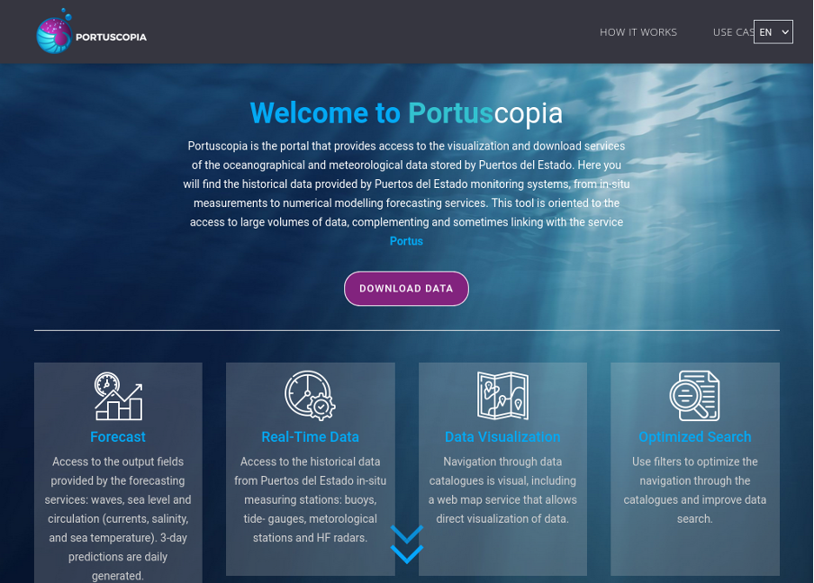
In addition, on the premise that navigating through such complex and changing inventories can be challenging for some users, a layer has been developed on top of the Thredds service to facilitate data searching and improve data downloading. This layer is called Portuscopia.
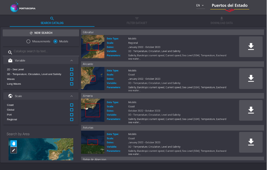
In Portuscopia navigation through data catalogues is visual. Users can apply filters in the search panel to select the search criteria and quickly identify the dataset of interest. The list of results will be displayed on the results panel. The search can be further narrowed down by selecting date ranges, parameters, and the geographical area to download/visualise data.
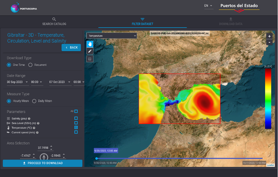
By means of an integrated web map service, Portuscopia also allows direct and interactive visualisation of data. Users can also select areas as well as zoom in and zoom out on the mentioned data maps to define the geographical region of interest as part of the data search.
Portuscopia allows 2 types of downloads:
- 1-click, for one-time downloads. In this case, the downloading process ends when the data files are instantly downloaded and saved on the user’s PC/server.
- Recurrent, which is designed for those users who need to download the latest available data on a regular basis. When users register for this type of download, Portuscopia will provide them with a script to automate downloads from their own servers.
Portuscopia is a more user-friendly layer of the Thredds service and incorporates links to other data download services of Puertos del Estado. In fact, it is intended to become the focal point for oceano-meteorological data downloading in Puertos del Estado.