Short title:
CNR-ISMAR HF Radar portal and THREDDS Catalog – data from the CNR-ISMAR HF radar network is made available for science, society and policy makers.
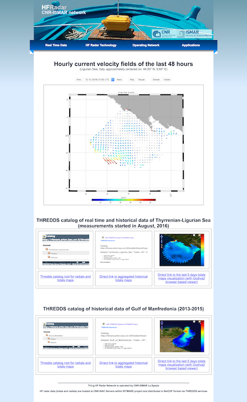
Short title2: HFR-TirLig (formerly LiSO-HFR)
Link to website: http://radarhf.ismar.cnr.it
Description:
Surface current data measured by the CNR-ISMAR HF radar network in the North Western Tyrrhenian Sea and in the Ligurian Sea are made available in graphical format for the last 48 hours and in real time and delayed mode via a THREDDS catalog which provides metadata and data access. The web site gives information on HF radar technology, sites position and operational parameters, and links to the THREDDS catalog. The catalog contains HF radar data in netCDF format according to the European standard data model and offers different remote-data-access protocols such as Open-source Project for a Network Data Access Protocol (OpenDaP), Web Coverage Service (WCS), Web Map Service (WMS) (OGS standards), as well as pure HTTP or NetCDF-Subsetter. They allow for metadata interrogation and data download (even sub-setting the dataset in terms of time and space) while embedded clients, such as GODIVA2, NetCDF-JavaToolsUI and Integrated Data Viewer, grant real-time data visualization directly via browser and allow for navigating within the plotted maps, saving images, exporting-importing on Google Earth, generating animations in selected time intervals. The data on the THREDDS catalog are accessible both in aggregated and in non-aggregated configuration.
The data set consists of maps of radial and total velocity of the sea water surface current collected by the HF radars in the North Western Tyrrhenian Sea and in the Ligurian Sea. Surface ocean velocities estimated by HF Radar are representative of the upper 0.3-2.5 meters of the ocean. The radar sites are operated according to Quality Assessment procedures and data are processed for Quality Control. Data access tools are compliant to Open Geospatial Consortium (OGC), Climate and Forecast (CF) convention and INSPIRE directive. The use of netCDF format allows an easy implementation of all the open source services developed by UNIDATA.
In the same area covered by the HF radar network, data from Acoustic Doppler Current Profiler installed on the Corsica Channel mooring (platform proposed within the JERICO-S3 TNA) are made available.
Institute:
Institute of Marine Sciences of the National Research Council of Italy (CNR-ISMAR)
Contact name: Carlo Mantovani, Lorenzo Corgnati
Contact email: Please login or register to view contact information.
Location: North Western Tyrrhenian Sea and Ligurian Sea
Tags:
THREDDS, TDS, HF radar, netCDF, current, velocity, remote sensing.